Hotel Casa Antonelli Malcesine


")
![]()
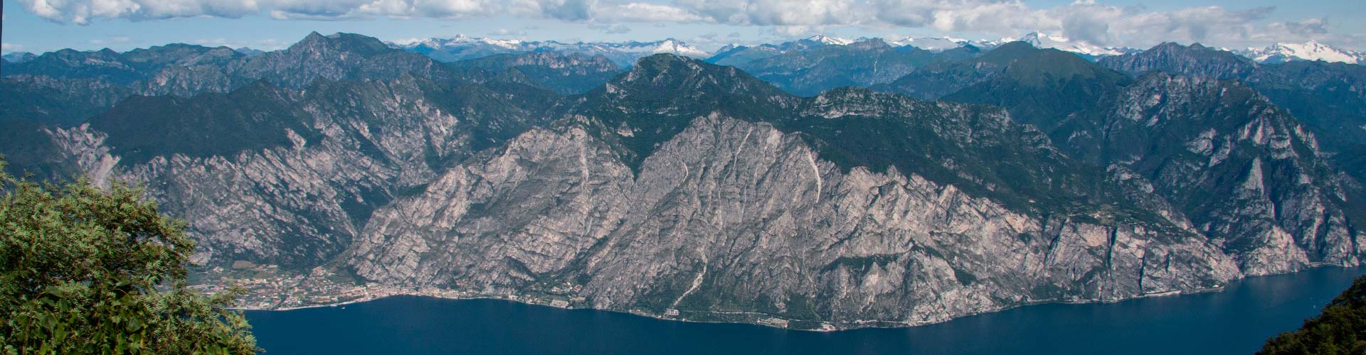
Tours - Excursions - Events
Recharge your batteries and Fun in Holidays
Some people looks for relaxing vacations: sun, beaches, pool, a good dinner and wine.
Others like to discover new destinations and traditions, that's why we though also to give informations about excursions, trips to towns on Garda Lake and visit to the near city of Verona and Trento.
In addition we wont to report some interesting events that take place on Garda Lake and Malcesine douring the summer season.
Tours - Excursions - Events
Tours
Malcesine - Limone / Riva del Garda; Giro del Lago di Garda : www.gardaescursioni.com
Battelli navigazione Lago di Garda: www.navigazionelaghi.it
Melsinea Viaggi : www.melsinea.com:
Lake Garda Tour / Venezia Classic / Dolomiti Wine Tour / Firenze / Verona Classic / Mantova & Sigurtà / Venezia Special / Venezia by Night / Brescia & Iseo / Milano City / Valpolicella Wine & Food / Bolzano & Renon
Excursions
Casa Antonelli invites you to discover Lake Garda with hiking guide for free of charge.
Every week you make walks to illustrate the natural beauty of Lake Garda. You will be accompanied by GERTRUD
Here all you need:
- Sports schoes with profiled soles
- Appropriate sportswear(trousers better if long)
- Hat and solar cream
- Water, a snack
How to participate?
- In the calendar are listed walks with a short path illustration
- Book at reception
Only the first 15 participants accepted!
HAVE FUN!
MALCESINE: FUBIA
EXCURSION VR1
POINT AND TIME OF MEETING: 9.00 am
to CABLE CAR Station MALCESINE - MONTE BALDO
HOW TO GET: by foot, by car or by Touristbus
LENGTH: approximately 6 Km
ALTITUDE: approximately ↨ 350 m
HIKING TIME: 3 - 3,5 hours
DESCRIPTION: This route is part of the most ancient paths of Malcesine who once brought to the olive groves situated on the plateau.
The walk starts at the valley station of the Monte Baldo cable car. After covering a piece on the sidewalk he turns to the mountain, where soon you enter in the historic "Via delle Vacche", an ancient cobbled road uphill. Turning around, you can admire the castle of Malcesine with Lake.
The path runs through olive groves and small houses until you reach the road to St. Michael (San Michele), which is crossed. From here the road rises slightly, passing near a rural house with olive groves to enter later in the underwood and get below the Monte Fubia.
It's time for a break and a snack. For the return you pass a stretch in the woods and in part it is the same route.
MALCESINE: VIA DEI PALI – FAIGOLO
EXCURSION VR2
POINT AND TIME OF MEETING: 9.00 am
at Parking in Campiano
HOW TO GET: by car
LENGTH: approximately 5,5 Km
ALTITUDE: approximately ↨460 m
HIKING TIME: 3 – 3,5 hours
DESCRIPTION: This walk also like the locals because not pass for the usual routes.
The view of the lake is unique because the trail leads to a certain altitude. By car you reach the Campiano pass (540 m above sea level), where there is free parking.
Initially there is a short asphalt section, then turns to the mountain where begins a steep and cobbled path. Now it has come to an initial altitude to continue almost flat through wonderful sights. Continuing on, the trail leads into the one leading from Navene (n. 4A) to continue to the small rural location of Faigolo.
It has reached the highest point of the walk. It is time for a snack, even admiring the view.
Then the path continues towards the Campiano pass.
MALCESINE: MADONNA DELL‘ ACCOGLIENZA
EXCURSION VR3
POINT AND TIME OF MEETING: 9.00 am
at BUS STATION in Malcesine
HOW TO GET: by foot, by car or by Touristbus
LENGTH: approximately 6,5 Km
ALTITUDE: approximately ↨ 300 m
HIKING TIME : 3 – 3,5 hours
DESCRIPTION: Nice walk to enjoy the view of the lake and the view from the top of Malcesine near the holy place.
Departure on foot from the bus station in Malcesine, continue for a piece on the asphalt road then you take the ancient routes of the place.
The cobbled street of the "Valley of Mulimento" is uphill and passes through the olive groves with ancient olive trees until you reach Val di Monte.
Here we continue for a while on the Via Panoramica. On an almost flat road you reach the balcony of Madonna.
Short break for snack. For the return you go down to Sant 'Antonio to reach Malcesine.
MONTE BALDO: VENTRAR
EXCURSION VR4
POINT AND TIME OF MEETING: 8.50 am
to CABLE CAR Station MALCESINE - MONTE BALDO
HOW TO GET: by foot, by car or by Touristbus
LENGTH: approximately 4,5 Km
ALTITUDE: approximately ↨ 80 m
HIKING TIME : 2,5 - 3 hours
DESCRIPTION: This walk is famous for the unique flowering of the Monte Baldo and the geological characteristics of this mountain.
With the cable car goes up to the upstream station. From there it proceeds through the flowering meadows on the west side of the Baldo with the view over the whole lake to reach the panoramic point Cima Ventrar. In good weather you can see the Brenta Dolomites and Adamello Glacier.
The path then continues on the eastern side of the location Colma and descends gently through the meadows with the various species of flowers.
The flora of course change with the season. After reaching the historic"Caserma", you take a break with a snack.
On the way back to the cable car station, maybe you can spot some marmots.
MONTE BALDO: CIMA POZZETTE
EXCURSION VR5
POINT AND TIME OF MEETING: 8.50 am
to CABLE CAR Station MALCESINE - MONTE BALDO
HOW TO GET: by foot, by car or by Touristbus
LENGTH: approximately 7 Km
ALTITUDE: approximately ↨ 400 m
HIKING TIME : 4 - 5 hours
DESCRIPTION: This walk is a classic among hiking on Monte Baldo. Climb by cable car up to the mountain station, altitude 1760 m above sea level.
The path starts from there and initially drops a piece up to Tratto Spino, then climb up the rocky ridge, not dangerous.
However, you can choose a more convenient route to the upstream station of a chairlift. From here the path continues with signs no. 651 in the direction of the Peaks and leads directly on Cima delle Pozzette.
The view over the entire length of Lake Garda is stunning. Time for a break and enjoy a sandwich.
For the return you take the same route.
MALCESINE: POZZO BARCHET
EXCURSION VR6
POINT AND TIME OF MEETING: 9.00 am
at BUS STATION in Malcesine
HOW TO GET: by foot, by car or by Touristbus
LENGTH: approximately 7,5 Km
ALTITUDE: approximately ↨ 390 m
HIKING TIME: 3 - 3,5 hours
DESCRIPTION: This is a walk that goes south of Malcesine.
Up to the locality Cher, follow the asphalt road, then start a short stretch of steep road and continue on the old stone paved mule track (No. 659) through the olive groves to the "Casa Tonda".
Now the trail begins to rise and leads through a typical Mediterranean coppice wood. The path becomes stony. Arrived at the highest point called "Pozzo Barchet" (470 m s.l.m.) you are under a 40 m high rock face, a place that invites you to stop. The path leads downhill, passing erratic boulders (Maroc) to Cassone, the most southerly village, which still belongs to the municipality of Malcesine.
Walking along the lake the walk leads to the starting point. (From Cassone, the tourist bus can be taken for the return journey).
MALCESINE: SS. BENIGNO E CARO
EXCURSION VR7
POINT AND TIME OF MEETING: 9.00 am
at BUS STATION in Malcesine BY CAR
HOW TO GET: by car
LENGTH: approximately 8,5 Km
ALTITUDE: approximately ↨ 550 m
HIKING TIME : 4 hours
DESCRIPTION: This walking is loved by the population because it leads to the sanctuary of their patron saints, Benigno and Caro.
By car, take the panoramic road that goes up for about 5 km to San Maggiore. Here you can park (for free). The walk is uphill, first on a paved road that then becomes a dirt road. The view falls on the lake below and on the flowered fields. The trail climbs and leads into a mixed forest. Here a beautiful alpine meadow opens in front of the hiker: Malga Fiabi
Continuing southwards, crossing a beech forest, we arrive at the small secular sanctuary consecrated to the SS. Benigno and Caro with hermitage.
The place is magical and the view from this height, 950 m altitude, is enchanting. Here a stop is earned, after which the same road takes us back to the starting point.
CASTELLETTO: CAMPO
EXCURSION VR8
POINT AND TIME OF MEETING: 9.00 am
at BUS STATION in Malcesine BY CAR
HOW TO GET: by car
LENGTH: approximately 5,5 Km
ALTITUDE: approximately ↨ 150 m
HIKING TIME : 2,5 – 3 hours
DESCRIPTION: Departure by car in the south direction to Castelletto. Parking only for a fee.
On foot, climb slightly uphill through the picturesque village, passing by typical courtyards and a chapel to the village of Biaza.
Always walking on the asphalt road you reach Fasor early and from there to the hiking trail. This leads into a gentle slope through the olive groves and offers a splendid view of the lake.
Quite unexpectedly, the first stone houses of the half-abandoned village of Campo appear. Of particular interest are the Roman fountain with spring water and the Romanesque church of San Pietro, recently restored with paintings inside.
At the end of the village an old mule track descends in the direction of Marniga, from where the return path leads along the lake to the starting point.
NAGO: MONTE ALTISSIMO DI NAGO
EXCURSION TN4
POINT AND TIME OF MEETING: 9.00 am
Navene (Malcesine North) - immediately after Hotel Villa Monica on the right side of the road
HOW TO GET: by car
LENGTH: approximately 8 Km
ALTITUDE: approximately ↨ 550 m
HIKING TIME : 4 - 5 hours
DESCRIPTION: You drive to Nago to continue on the narrow mountain road that leads to several hairpin bends to the Alp "Prati di Nago" (1500 m s.l.m.). Here you can park (for free).
Now the walk begins along the path n. 601 uphill until you reach a ridge from where you can enjoy a magnificent view of the lake.
The route continues to the "Monte Altissimo D. Chiesa" refuge. To reach the highest peak of Monte Altissimo di Nago (2079 m s.l.m), there are still approx. 30 meters above sea level and is easily accessible.
The view from this trigonometric point is breathtaking.
There is the possibility to use the Refuge. For the return, we could consider the path n. 622 for “Bocca Paltrane”.
From the Bocca, go down a narrow path, a little steep that runs along the flowery slopes and then head towards the enchanting alpine meadows to the starting point towards the parking lot.
ARCO: SENTIERO DELLA MAESTRA
EXCURSION TN1
POINT AND TIME OF MEETING: 9.00 am
Navene (Malcesine North) - immediately after Hotel Villa Monica on the right side of the road
HOW TO GET: by car
LENGTH: approximately 6 Km
ALTITUDE: approximately ↨ 350 m
HIKING TIME: 3 - 4 hours
DESCRIPTION: In location Moletta, north of Arco (free parking) begins the walk along a cobbled street, which was named in memory of a courageous teacher, who traveled this road to get to school in monoclass in these dispersed locations.
The beginning of the trail is quite steep, but soon you reach a Mediterranean undergrowth with panoramic points.
After crossing a chestnut and passing near the cave drawings of the bronze period, the path leads to the old disused quarries of Olite.
It is a clear rock, which has been employed in different buildings from the 19th century.
After reaching the closing of the valley, there is a view on the Lago di Garda. The asphalt road takes us back to start point.
RIVA DEL GARDA: VOLTA DI NO – TENNO
EXCURSION TN2
POINT AND TIME OF MEETING: 9.00 am
Navene (Malcesine North) - immediately after Hotel Villa Monica on the right side of the road
HOW TO GET: by car
LENGTH: approximately 5 Km
ALTITUDE: approximately ↨ 150 m
HIKING TIME: 2,5 - 3 hours
DESCRIPTION: By car, it goes over the small village Cologna on the road to Tenno (free parking).
This walk is also suitable in the summer, thanks to the vigorous vegetation.
Passed the Novino sources, the road turns to the south, through terraced vineyards and olive groves.
A particularly scenic location with beautiful views over Lake that lends itself for a break and a snack. You get to Tenno with its medieval castle, passing for houses typical of the place.
The return way takes us back in the vineyards up to the starting point.
TENNO: CALVOLA - RIFUGIO SAN PIETRO
EXCURSION TN3
POINT AND TIME OF MEETING: 9.00 am
Navene (Malcesine North) - immediately after Hotel Villa Monica on the right side of the road
HOW TO GET: by car
LENGTH: approximately 4,5 Km
ALTITUDE: approximately ↨ 400 m
HIKING TIME: 3 - 4 ore
DESCRIPTION: You get to Calvola by car (free parking). From there, begins a steep path marked with n. 401, called "Sentiero Frassati".
The beautiful views of Lake Garda reward the effort. Then the trail enters in a coppice wood to reach the Rifugio San Pietro, where there is also the small church.
The view of the lake is wonderful. The refuge gives the possibility of refreshment.
The way back runs more gently through wooded areas and meadows, until you reach the village of the "Artists": Canale with the typical houses of the past.
From there you returns to Calvola, where you can enjoy a glass of homemade wine in a farm.
Book at reception
www.excursionmalcesine.info
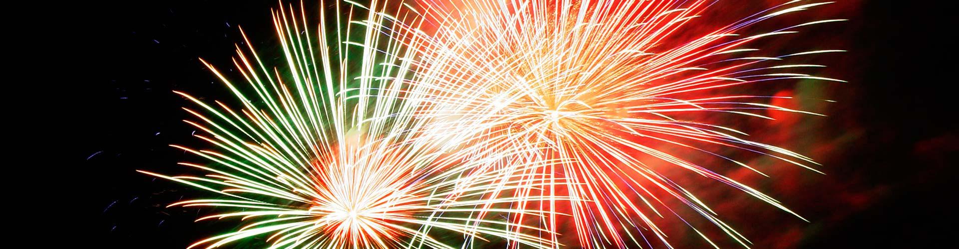
Events
Malcesine: www.visitmalcesine.com
Riva del Garda: Notte di Fiaba 24.08 - 27.08.17: www.nottedifiaba.it
Verona: Arena di Verona Opera Festival 2017: www.arena.it
![]()
HOTEL CASA ANTONELLI **
Via Dos del Pis 12 - 37018 Malcesine Lake Garda VR - Italy
Tel +39 045 740 07 30 - Fax: +39 045 658 35 32
E-mail: - Website: www.casantonelli.com
VAT IT03445970233
What Travelers say about us - Privacy Policy - Cookie Policy - Sitemap - Contact
Room rates: €52 - €122